OIL-RIG/LEAK
Posted on May 29, 2010 by Jeffrey Newman
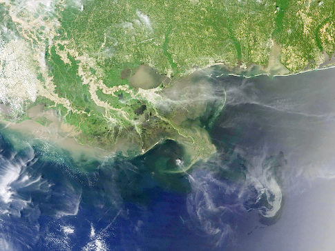
This image from the Moderate Resolution Imaging Spectroradiometer (MODIS) on NASAs Aqua satellite on May 10, 2010 and released by NASA on May 17, shows the oil spill which has remained in the Gulf of Mexico not far from the Mississippi Delta. Thin, wispy clouds partially obscure the satellite sensors view of the ocean surface south of the Mississippi Delta, but oil on the waters surface is still apparent southeast of the delta. The most obvious portion of the gray-beige slick arches toward the west, with inward-curling tendrils. REUTERS/NASA/ MODIS Rapid Response Team/Handout (UNITED STATES – Tags: DISASTER ENVIRONMENT) FOR EDITORIAL USE ONLY. NOT FOR SALE FOR MARKETING OR ADVERTISING CAMPAIGNS Original Filename: 2010-05-17T194027Z_01_LOA02_RTRMDNP_3_OIL-RIG-LEAK.JPG